The closest train and bus station to the start of the route is Navalmoral de la Mata. Currently, the following companies provide transfer services for people, luggage and bicycles along the entire route, both to start and to manage the return. They also have bicycles for rent:
The entire route is signposted, taking into account the criteria of sustainability, effectiveness and efficiency, minimising the visual impact of the signs on the ground and complying with the Tourist Signs Manual of the Regional Government of Extremadura.
These are the various signs you will find
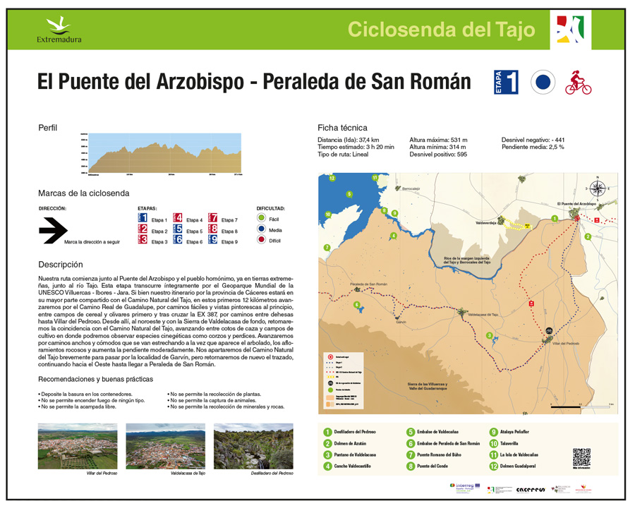
Route Start Panel
This panel will provide information at the start of the route, and in the event of long routes, also of each of its stages. It contains a route map (route, points of interest, features resources etc.), profile, technical data (distance, accumulated levels), difficulty, signage types, recommendations and limitations, description and photographs of landmarks.
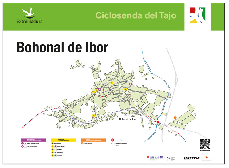
Population information panel
These panels identify the towns and villages that the cycle trail crosses. These panels offer the user a route to cross these, avoiding the signs inside the towns, offering all the necessary information in their regard: places of interest, information points etc.
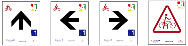
Directional arrows
These flag-type signs identify the routes the visitor is on, as well as the distance and direction to other features of interest such as towns, tourist resources, visitor centres etc., included or not in the route itself. As regards the Tajo Cycle Trail, we will often find the sign “overlap with the River Tajo N.T.” which indicates that the signs of the GR 113 for hikers must be followed until further notice,
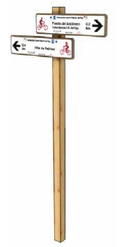
Directional beacons
These arrow-type plaques identify the continuity of the route and the direction of travel.
Download the tracks
Download the tracks in GPX format to follow all the stages of the route from your mobile phone.